PG&E Central Coast Seismic Network operated by Pacific Gas and Electric Company
Overview
Pacific Gas and Electric Company (PG&E) operates a diverse seismic instrumentation program for monitoring seismic activity throughout its territory in California. The primary purpose of the program is to provide access to earthquake data by PG&E engineers and seismologists for rapid response to earthquakes that affect PG&E's critical buildings and facilities. PG&E currently has 98 strong motion instruments; 10 at dams, 33 at substations, 14 at power plants, and 31 in buildings. As part of a partnership with PG&E, California Geological Survey (CGS) owns and operates 31 of the instruments at substations and buildings, USGS owns and operates 3 and Berkeley owns and operates 2. Of the 14 instruments at power plants, 12 are weak and strong motion instruments that comprise the Central Coast Seismic Network (CCSN), located along the south-central CA coast. CCSN data are streamed to PG&E-San Francisco for analysis and shared with the USGS Menlo Park where it is integrated with other data from the Northern California Seismic Network (NCSN).
Network Code: PG
Station Information
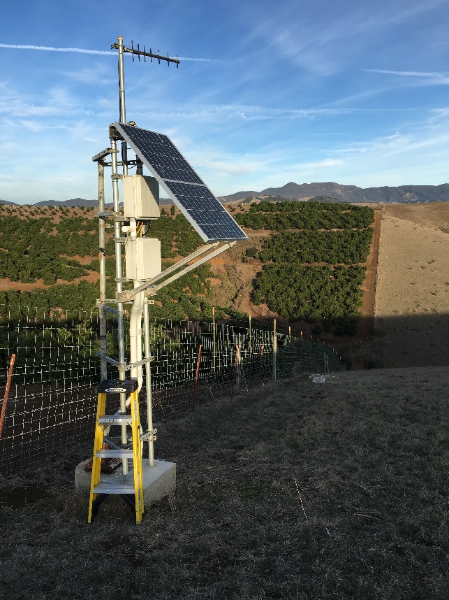
- Short-period sensors
- Vertical-component velocity sensor (S-13 or L4C)
- Continuous telemetry to PG&E and USGS Menlo Park
- Backup power supply
- Channel names EHZ, EHN, and EHE
- Strong-motion sensors
- 3-component accelerometer (Reftek 131A)
- 3-component seismometer (S-13 or L4C)
- Reftek 130-01 data logger
- Continuous telemetry to PG&E and USGS Menlo Park
- Backup Power Supply
- Channel names HHZ, HHN, HHE, EHZ, EHN, and EHE.
- PG Information Directory, including
- List of station locations
- List of available channels
- Instrument Response
Data access
Several tools provide access to SEED format data at the NCEDC, both in terms of querying the archives and allowing data requests:
- Querying the archives
- Access data through NCEDC web services